Overview
The diverse range of extreme weather phenomena across the mid-Atlantic region explores a wide range of system states, couplings and feedbacks within the natural system, and between the natural and human systems. Although, the use of antecedent soil moisture is commonly used in predictions of stream discharge and flooding this information alone does not account for characteristics of the local hydrogeology that can impact groundwater surface water interactions and flooding. For example, a recent storm near Harberson Delaware delivered 13 inches of rain in a day, causing the water table to rise nearly five feet in less than two days. Although the water table dropped by two feet during the following week, a subsequent rain storm bringing only 3.6 inches of rain led to groundwater driven flooding. This response to a sequence of events highlights the important role that both antecedent groundwater elevation and lateral groundwater flow can play in flooding events in this region. Similarly, a prolonged drought or other disturbance, such as a wildfire, may alter the soil in such a way that little infiltration is possible, leading to extreme overland flows. We are interested in exploring the use of a more complete antecedent hydrologic state to improve predictions of stream discharge and flooding.
The ESS program will use its expertise, along with the flexible high-fidelity mechanistic models it is developing for these integrated hydrologic systems, to address the following scientific question:
- How does the antecedent state of the hydrologic system (e.g., soil moisture, ground water elevation, snowpack) and its integrated response to extreme weather events, impact flooding in the mid-Atlantic coastal zone?
Impact of Antecedent Hydrologic State on Flooding
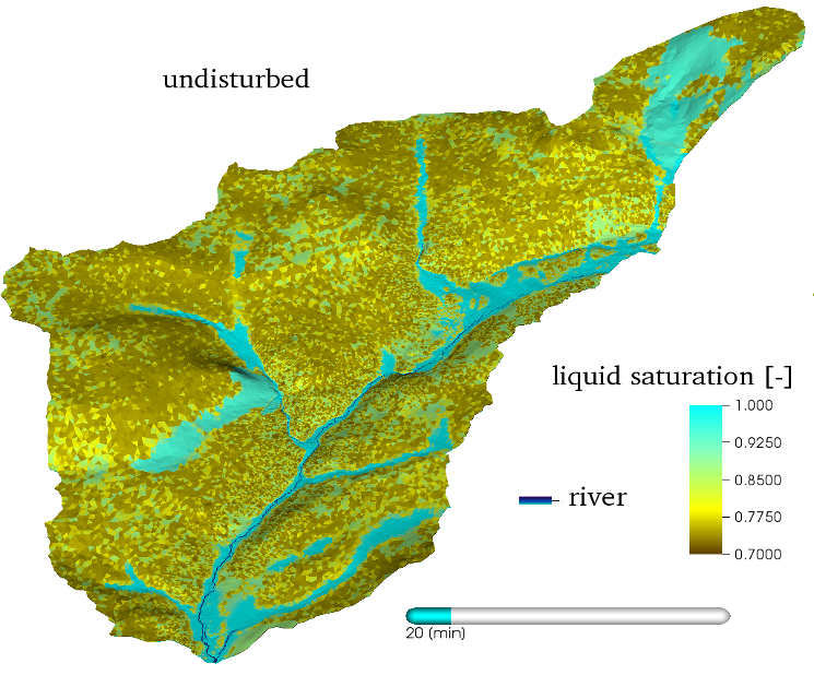
We will use a phased approach to address this fundamental science question, building a series of integrated hydrology models using ATS and scenarios of extreme weather events guided by real data and experiments in the other program areas. Initially, we will identify areas of the mid-Atlantic, particularly in the Delaware and Susquehanna watersheds and coastal zones, where extreme weather events have led to flooding in the past. In these areas, we will use digital elevation, soil, vegetation, and land use maps from USGS to develop the ATS models. We will use selected historical data to spin-up representative models of very dry (drought) conditions, very wet (heavy snow pack, extreme precipitation) conditions, and “normal” conditions. These initial states will then be forced with extreme precipitation events from the cross-cutting program area to study the influence of initial ground water levels on flooding, including multiple sequential extreme events. To explore validation, we will first compare uncalibrated results with past system behaviors. We will then use part of the available data set (e.g., stream flows and flood extent) to calibrate parameters and compare predictions from the model with the remaining data. Through this work we will quantify the critical role that the tight coupling of ground water and surface water has on flooding in the mid-Atlantic coastal zone, identify the quantities that capture a more complete hydrologic state, and advance tools that can be used to explore these interactions more broadly.