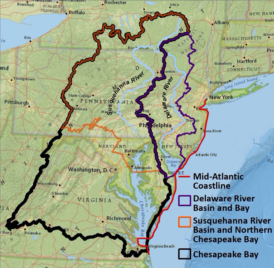
For the initial three-year phase of this project (2020-2022), our modeling and analysis activities will focus on the coastal mid-Atlantic region of the United States, which we are defining as the Delaware River and Bay, the Susquehanna River and Chesapeake Bay, and the coastline stretching from New Jersey to southeastern Virginia. This region provides a natural laboratory for examining a wide range of natural hazards and human-induced stresses, including hurricanes, droughts, sea level rise, urbanization, aging infrastructure, population shifts, and hypoxia, that pose important risks to human and natural systems.
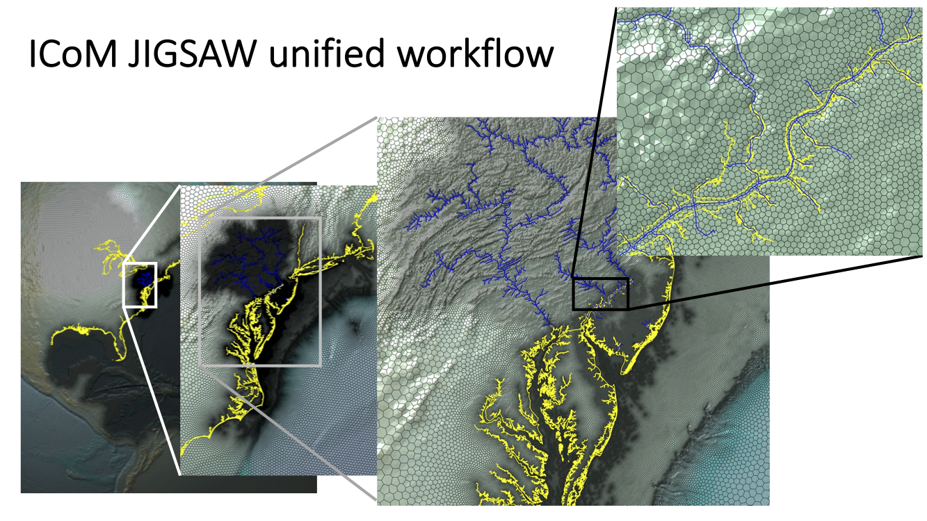
ICoM will use a range of different modeling tools, each with its own geographic domain and spatiotemporal resolution, to resolve different processes and interactions. Many of these models will leverage the JIGSAW workflow to produce unified meshes that resolve key geographic features in a common framework.